Altopiano del Sole - Bedzanaglio
Main menu:

Altopiano del Sole
Destinations
“Altopiano del Sole” is synonym of beautiful landscapes, perfect relax and healthy walks suitable for all ages and for all seasons.
Various hiking trails start from Borno old town where “B&B Zanaglio” is located. The trails immerse the guests in a unique and environmentally friendly naturalistic setting.
In addition to healthy walking and horse riding, the surroundings of Borno also offer many routes for mountain-bike and e-bike. These can be rented at the "Bonk Shop", clothing and sports equipment store, at favorable conditions for all guest of B&B Zanaglio.
| Trails | Places | |
| 1 | BORNO m. 1000 – DASSINE – BALESTRINI - MALGA MINE – PAGHEROLA m. 1.528 Hiking – Lenght: km. 5 – Travel time: h. 2.00 – Sources of water on the trail – Landscape and naturalistic interests | |
| 2 | BORNO m. 1000 – LAZZARETTI – FONTE PIZZOLI – BALESTRINI m. 1.171 Tourist – Lenght: km 3,300 – Travel time: h 1.10 – Sources of water on the trail – Landscape and naturalistic interests | |
| 3 | BORNO m. 1000 – LAZZARETTI – BAITA MENSI – PLAI – PIAN D’APRILE – PAGHEROLA – MONTE ALTISSIMO m. 1.703 Hiking – Lenght: km 5,300 – Travel time: h 2.40 – Sources of water on the trail – Naturalistic interests | |
| 4 | PLAI m 1.305 – MALGA CORVINO – FONTANA DI PREDAZZO – MALGA GUCCIONE m. 1.427 Tourist – Lenght: Km 1,600 – Travel time: h 0.30 – Sources of water on the trail – Landscape and naturalistic interests | |
| 5 | OGNE (Campeggio Bosco Blu) m. 1060 – TRIANGOLO – MALGA CORVINO – SENTIERO DEI RESTEI – VAL SORDA (Pozze) m. 1.386 Hiking – Lenght: Km 4,700 – Travel time: h 1.45 – Sources of water (Malga Corvino) - Landscape interests | |
| 6 | CROCE DI SALVEN m. 1.109 – VAL SORDA – MALGA PRATOLUNGO – MALGA GUCCIONE – MONTE ALTISSIMO m. 1.703 Hiking – Lenght: Km 7,600 – Travel time: h 3.00 – Get water on the trail - Landscape interests | |
| 82 | BORNO m. 1000 – LAGO DI LOVA – MALGA MOREN – RIFUGIO SAN FERMO m. 1.868 – “SENTIERO ALTO” – RIFUGIO G. LAENG m. 1.760 Hiking – Lenght: Km 11 – Travel time: h 3.45 – Sources of water only up to Malga Moren - Landscape interests | |
| 82A | RIFUGIO LAENG m. 1.760 – PIZZO CAMINO m. 2.491 Experienced hikers – Lenght: Km 4 – Travel time: h 2.00 – Get water on the trail - Landscape interests | |
| 82B | MALGA MOREN m. 1.595 – CIMA MOREN m. 2.418 Experienced hikers – Lenght: Km 3,700 – Travel time: h 2.30 –Sorces of water (Malga Moren) - Landscape interests | |
| 100 | BORNO m. 1000 – FREAL – AVENDRINO – MALGA ZUMELLA – RIFUGIO SAN FERMO m. 1.868 Hiking – Lenght: km 4,200 – Travel time: h 2.30 – Sources of water on the trail – Landscape interests | |
| 101 | CROCE DI SALVEN m. 1.109 – DOSSO LUNGO – VAL DI CALAPENDRIZZA – MALGA ZUMELLA m. 1.565 Hiking – Lenght: km 3,900 – Travel time: h 1.30 – Sources of water on the trail – Landscape interests | |
| 102 | CROCE DI SALVEN m. 1.109 – GIOVETTO DI PALINE – MALGA CREISA – ROCCOLO DEL GATI’ – PASSO COSTONE m. 1.937 Hiking – Lenght: km 6 – Travel time: h 2.00 – Sources of water only up to a Malga Creisa – Naturalistic interests | |
| 103 | LAGO DI LOVA m. 1.300 – COLLE DI MIGNONE – PERIPLO MONTE MIGNONE – COLLE DI MIGNONE – LAGO DI LOVA Hiking – Lenght: km 6,700 – Travel time: h 2.15 – Sources of water only up to a Colle Mignone – Landscape interests | |
Natural Park “Boschi del Giovetto di Paline”
This protected area is located above Borno and Azzone, expanding over the ridge which divides Scalve Valley and Camonica Valley. The park is reachable through sign posted trails, it is famous for its resinous woods, meadows and green pastures with presence of rare animals and plants. The park is ant “Rufa” habitat, precious insect who keeps the woods healthy and clean, protecting the trees from the parasites devastation.
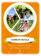
Itineraries “Corri in tavola”
Trekking lovers choosing slow pace and those fond of running and mountain bike can chose a guide equipped with QR Code intitled “Corri in tavola” which offers trails accompained with various traditional dishes from “Altopiano del Sole”. On www.corriintavola.it you can find details of below trails, along with tasty recipes of local dishes:
Hiking trail “L’Insolito Comignolo” – Simple – Km 3,72
Hiking trail “Le Palete” – Simple – Km 6,42
Hiking trail “Abeti Rossi” – Simple - Km 5,53
Hiking trail “Sogno Presolana” – Simple – Km 7,57
Hiking trail “Ruscelli Canterini” – Simple – Km 6,20
Hiking trail “Streghe” – Simple – Km 7,44
Hiking trail “Ciclamini” – Simple – Km 8,43
Hiking trail “Pietre e degli Dei” – Simple – Km 13,90
Hiking trail “Falco Pellegrino” – Difficult - Km 16
Hiking trail “Paradiso” – Very difficult - Km 20,54